Using Space-Tech to Combat Extreme Heat and Climate Change
Temperatures are soaring. Well past forty deGrees Celsius. That kind of heat is tearing up daily life across cities right now. And somewhere in the background, an emerging space-tech start-up is trying to use satellite data to help people deal with this dangerous heat this summer.
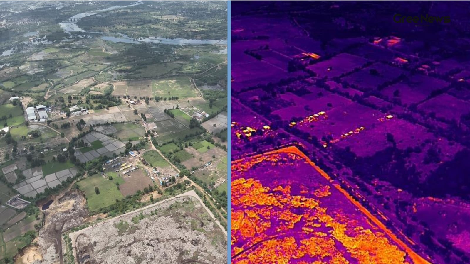
Satleo Labs is one of those players. They built a platform, recently launched in Ahmedabad, which is currently hammered by this season's severe heat. How they do it? They use satellite thermal technology mixed with AI analytics. It maps out those urban heat hotspots and spits out three-day forecasts. The accuracy is pretty good, around two or three deGrees Celsius.
They teamed up with the Ahmedabad Municipal Corporation, or AMC. The goal was to give citizens specific heat advisories, right where they are. You scan a QR code, and you get location-specific heat warnings. This really helps the folks who are most exposed—the outdoor gig workers, the delivery drivers, the cab drivers. They spend so much time outside, they feel the heat the most.
Shravan Bhati, the co-founder and CEO, said they wanted to combine space technology with climate planning to get a better response to this extreme heat. He pointed out the core problem: temperatures keep rising, cities are changing fast. And they just don't have the high-resolution, hyperlocal climate data they need.
The weather department throws out color-coded alerts for whole regions based on the highs and lows. But that’s just averages. You know how it is, temperatures swing wildly inside a city. Depending on where the Green spaces are, the amount of concrete, how dense the population is—it all changes things.
That’s where the team stepped in. They bridged that gap using thermal intelligence from low-earth orbit. They use open-source thermal datasets from satellites like MODIS and Landsat.
But those satellites? Their resolution is kind of coarse for getting super precise city-level details. So they had to build their own stuff. Proprietary AI algorithms to crank up that low-resolution thermal imagery. Turning it into detailed thermal intelligence layers.
They fed historical data, collected over five or ten years, into these models. Then they layered on real-time satellite observations. This builds predictive models. They can forecast where the heat hotspots will be and what the hyperlocal temperature patterns will look like for the next three or four days. They did this for Ahmedabad, and Tumkur in Karnataka. And they plan to push it to other cities. They’re even planning to launch their own thermal satellite soon.
This isn't just for comfort. The platform shares these heat-risk insights with government clinics and frontline health workers. It helps them prepare for heat-related illnesses. If an area is flagged for extreme heat, officials can move fast. Set up temporary clinics. Deploy extra medical staff. Prepare for heatstroke cases.
India is having this extreme heat again this summer. Large swathes of the country are being swept by intense heatwaves. Western states like Gujarat and Rajasthan are really taking the hit. Temperatures settle way above forty-five deGrees Celsius for days. Barmer hit 48.3°C at its peak.
The nights are getting warmer too. The weather department is warning about minimum temperatures being above normal levels in May. Scientists are clear now. Climate change has made these heatwaves more intense. More frequent. Longer. It’s hitting people and the economy hard.
With accurate temperature intelligence becoming this crucial for everything, space-tech startups are jumping in. India has seen a huge surge in space start-ups since the government opened up the sector for private money back in 2020.
The idea is that a satellite-based platform is way better than relying on expensive IoT devices or drone surveys for monitoring temperatures. Those methods cost a lot of money, several lakh rupees. This satellite approach offers a scalable alternative. It spots urban heat islands. It tracks where Greenhouse gases are hot spots. It helps city authorities react better to dangerous heat.
Written by Gree News Team — Senior Editorial Board
Gree News Team covers international news and global affairs at Gree News. Our collective of senior editors is dedicated to providing independent, accurate, and responsible journalism for a global audience.
More from India
View All
Political Speculation and Internal Turmoil within the TMC
Fresh visuals surfaced of Sushmita Dev meeting Assam Chief Minister Himanta Biswa Sarma. That kind of thing just kicks the speculation into high gear about her next move. It’s all about her potential entry into the BJP, right? This happened right after she stepped down from Rajya Sabha and walked ou
Jun 10, 2026 by Gree News Team
Threats and Intimidation Against Former Judge Justice Gautam Patel
Chief Justice Surya Kant stepped in on the matter involving threats and intimidation aimed at former Bombay High Court judge Justice Gautam Patel. This happened while he was visiting the UK, raising the issue with India’s High Commissioner there. It came out of a report by The Times of India. The wh
Jun 10, 2026 by Gree News Team

The Political Feud: Shivakumar vs. Kumaraswamy and the Vokkaliga Rivalry
A meeting that hasn't even happened is already sparking political sparring. Karnataka Chief Minister DK Shivakumar and Union Minister HD Kumaraswamy. It just underlines how bitter one of the state’s longest-running rivalries still is. Shivakumar was doing some outreach, a carefully choreographed exe
Jun 10, 2026 by Gree News Team
The Global Nuclear Arms Race: Spending, Capabilities, and Future Risks
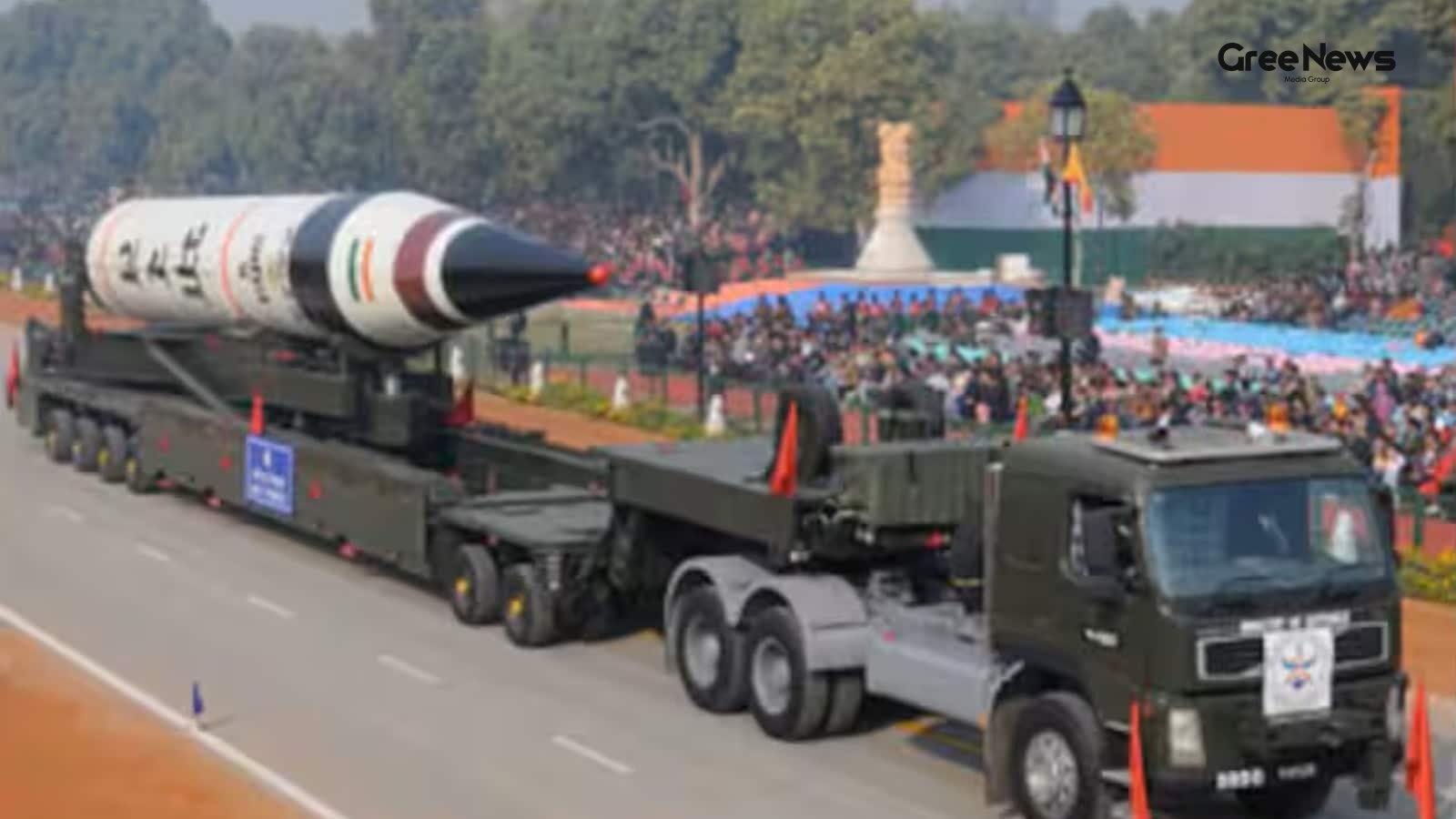
Nearly eight decades since Hiroshima and Nagasaki. And the world’s nuclear powers aren't slowing down. They keep spending more, modernizing faster, and experts are watching them move weapons out of storage and into potential use. It’s a real arms race happening right now. The nine states that hold n
Jun 10, 2026 by Gree News Team
Latest Headlines
Political Speculation and Internal Turmoil within the TMC
Fresh visuals surfaced of Sushmita Dev meeting Assam Chief Minister Himanta Biswa Sarma. That kind of thing just kicks the speculation into high gear about her next move. It’s all about her potential entry into the BJP, right? This happened right after she stepped down from Rajya Sabha and walked ou
Jun 10, 2026 by Gree News Team

FIFA World Cup 2026: Structure, Geography, and the Official Match Ball
The FIFA World Cup 2026 is really starting to feel imminent now. It’s heading toward North America the USA, Mexico, and Canada are slated to host this massive global spectacle. People are talking about it constantly. It’s not just a standard tournament anymore. This time around, they’re throwing way
Jun 10, 2026 by Gree News Team

Lionel Messi and Argentina's World Cup Journey in Group J
Argentina’s taking on Group J in this new setup USA, Mexico, and Canada it feels like more than just football now. It’s about that farewell, isn't it? Lionel Messi is chasing something special right now, playing out this final chapter with the Albiceleste against Algeria, Austria, and Jordan. There’
Jun 10, 2026 by Gree News Team

Federal Judge Bars Nitrogen Gas Execution in Alabama
A federal judge just slammed the door shut on Alabama’s plan to use nitrogen gas for executing Jeffery Lee. Permanently barred it, ruling the method violated basic constitutional rights about cruel and unusual punishment. This decision dropped like a stone. It came just one day after an appeals cour
Jun 10, 2026 by Gree News Team
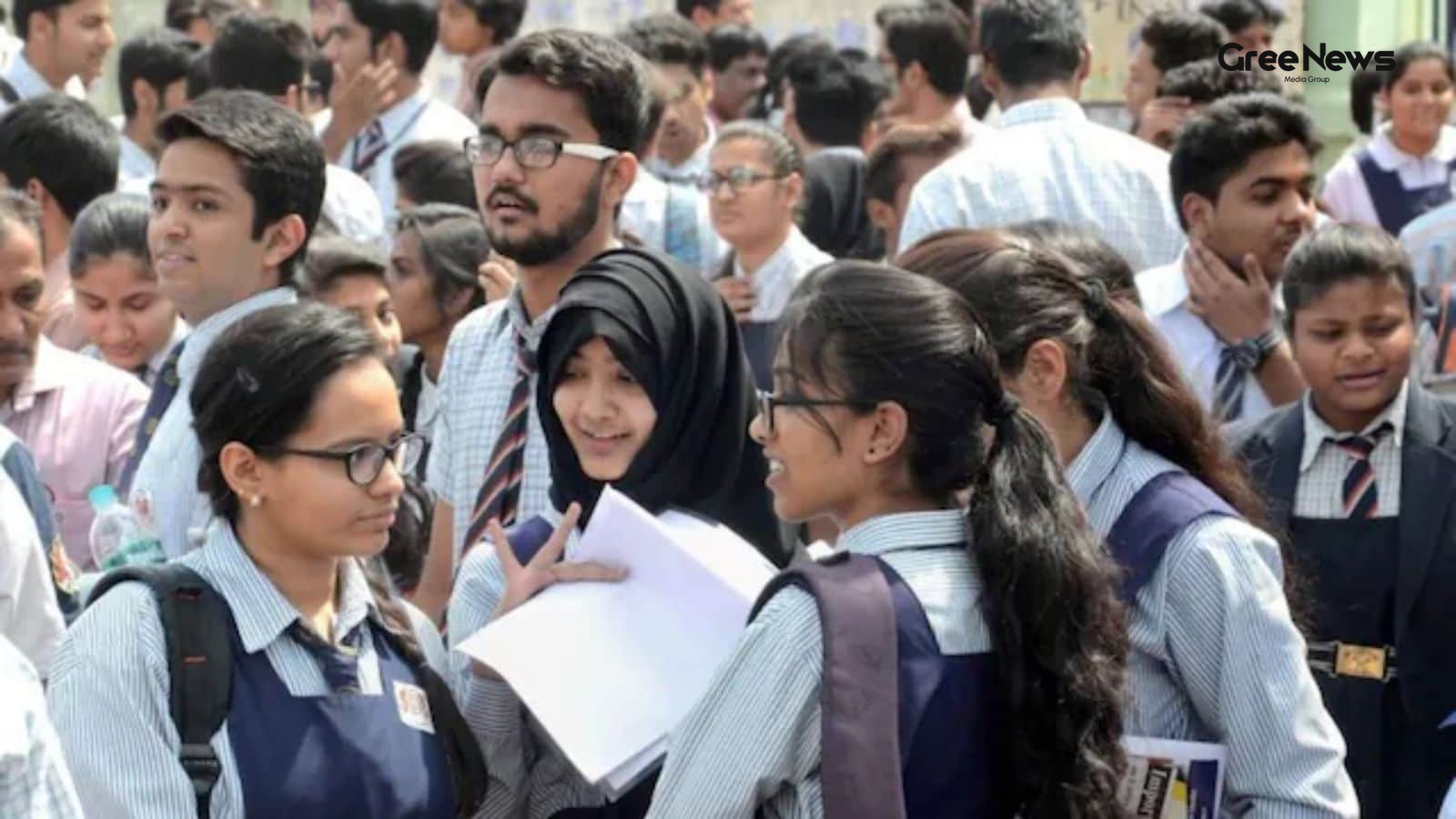
Kerala Board Plus One Results 2026 Announcement and Checking Methods
The Kerala Board Plus One results for 2026 are finally coming today, June 10th. That’s when the Directorate of Higher Secondary Education will officially announce everything. Students who took the DHSE Kerala Class 11 exams in 2026 can start checking their scores now. You have a few places to look,
Jun 10, 2026 by Gree News Team
Threats and Intimidation Against Former Judge Justice Gautam Patel
Chief Justice Surya Kant stepped in on the matter involving threats and intimidation aimed at former Bombay High Court judge Justice Gautam Patel. This happened while he was visiting the UK, raising the issue with India’s High Commissioner there. It came out of a report by The Times of India. The wh
Jun 10, 2026 by Gree News Team

Intersection of Art, Politics, and Public Morality at Film Screening
The buzz around the screening for ‘Bharat Bhhagya Viddhaata’ was definitely something special that Tuesday evening in Delhi. It wasn't just about watching a movie; it felt like a convergence a mix of film fans, some political heavyweights, and a surprising amount of high-level government presence. P
Jun 10, 2026 by Gree News Team
The Political Feud: Shivakumar vs. Kumaraswamy and the Vokkaliga Rivalry
A meeting that hasn't even happened is already sparking political sparring. Karnataka Chief Minister DK Shivakumar and Union Minister HD Kumaraswamy. It just underlines how bitter one of the state’s longest-running rivalries still is. Shivakumar was doing some outreach, a carefully choreographed exe
Jun 10, 2026 by Gree News Team

Protest and Political Standoff in Mexico City Before the World Cup
A protest choked off an avenue leading right to Mexico City’s Azteca Stadium for hours on Tuesday. It was just days before that massive World Cup opening match. As football fans started flooding in, all those co-hosts the US, Canada, and Mexico you see the real mess happening back home. Thousands of
Jun 10, 2026 by Gree News Team
The Global Nuclear Arms Race: Spending, Capabilities, and Future Risks
Nearly eight decades since Hiroshima and Nagasaki. And the world’s nuclear powers aren't slowing down. They keep spending more, modernizing faster, and experts are watching them move weapons out of storage and into potential use. It’s a real arms race happening right now. The nine states that hold n
Jun 10, 2026 by Gree News Team

The Chaos of Cinema: Volume, Competition, and the Shifting Market
The Friday arrived packed. June 12th. It wasn't just another day; it was a collision of cinema. Nine films, all hitting the screens at once. *Main Vaapas Aaunga*, Imtiaz Ali’s directorial effort. Then you had Kangana Ranaut’s *Bharat Bhhagya Vidhaata*. And the horror mixed in Vikram Bhatt’s *Haunted
Jun 10, 2026 by Gree News Team

Stock Market Updates: June 10th Performance and Sector Analysis
Stock market updates today, June 10th. Everything turned sour in late trading Wednesday. Domestic equity markets basically gave up all those gains they managed to hold during the day. Heavy selling hit midcap, smallcap stocks, plus metals, realty, and financial names dragging the main indices into n
Jun 10, 2026 by Gree News Team
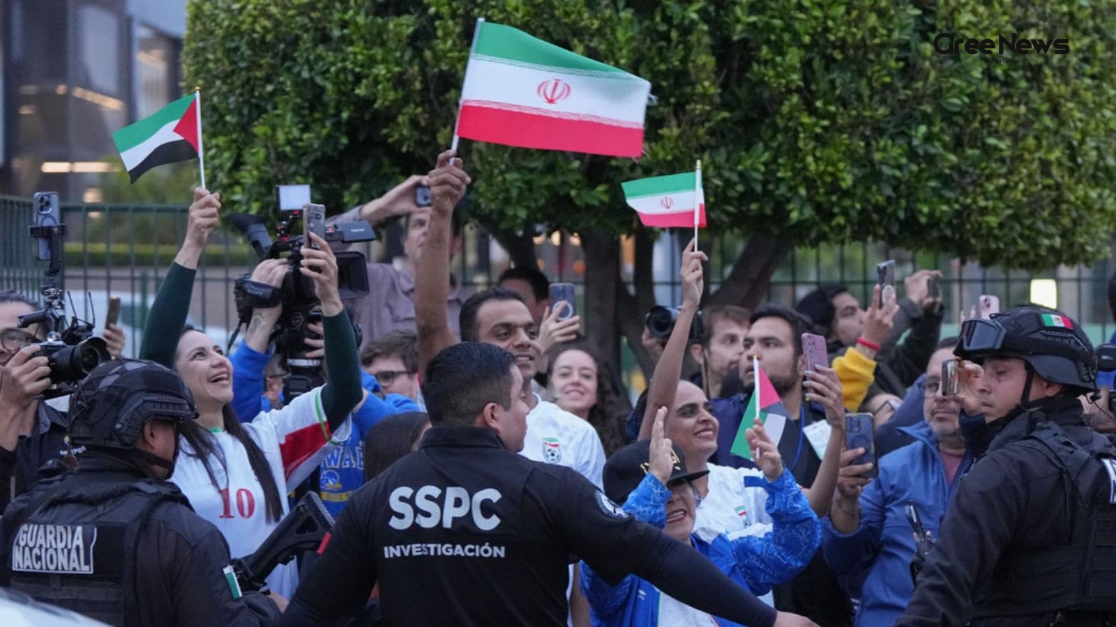
Iran Football Team Travel and World Cup Arrangements
Iran’s football team is heading to Los Angeles, apparently. They announced Tuesday that they'll be flying there the day before their first group-stage game against New Zealand. It feels like a lot happening all at once. But where exactly will they be staying? They won't actually be in L.A. for long.
Jun 10, 2026 by Gree News Team

The Impact of Gen AI on Job Applications and Hiring Strategies
When you start looking for a job, everyone builds this whole structure: the résumé, that killer cover letter, tailoring it perfectly. The whole point was always that application could make you jump out from the crowd of hundreds of applicants. But honestly? Recruiters are starting to think that play
Jun 10, 2026 by Gree News Team
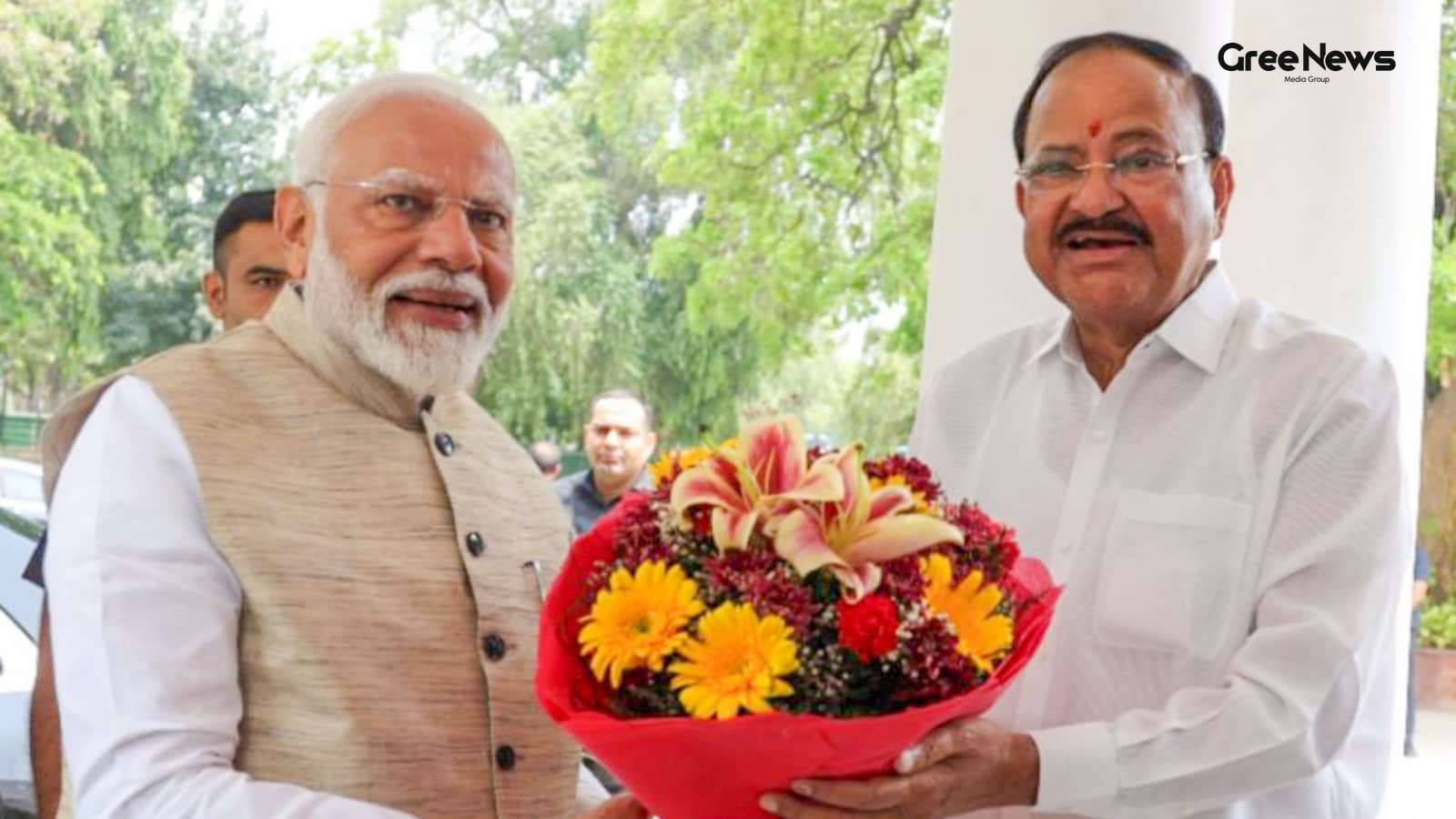
Narendra Modi's Milestone: India's Longest-Serving Prime Minister
Narendra Modi just hit a huge milestone. India’s longest-serving elected Prime Minister. Forty-three hundred ninety-nine days in office now. That beats Nehru's record, which was the first one. Former Vice President Venkaiah Naidu spoke about it. He praised the leadership and everything Modi has done
Jun 10, 2026 by Gree News Team