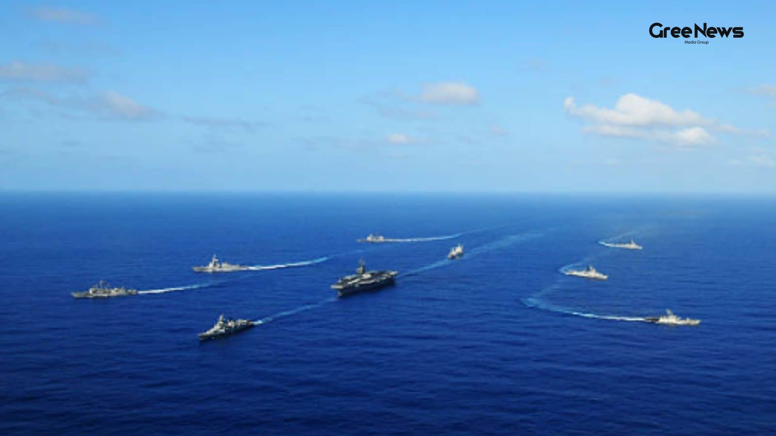
Satellite Imagery Reveals Oil Transfers in the Gulf of Oman and Strait of Hormuz
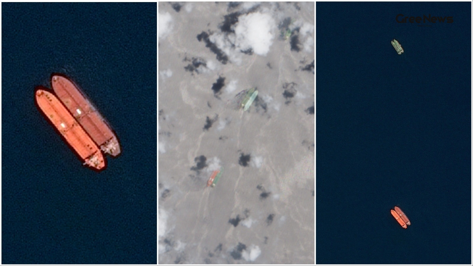
Satellite images from May 2nd through June 11th reveal something pretty intense happening in the Gulf of Oman and near the Strait of Hormuz. It’s a sprawling network of tankers moving oil offshore, side by side for extended periods.
We’re talking about transfers happening at least two spots: one off Fujairah in the UAE, and another near Sohar in Oman. It looks completely out of sync with normal shipping activity you usually see in that part of the region. Multiple pairs of vessels just hanging around while cargo gets moved between them. Just waiting.
Then there’s the specific snapshot from June 9th. The imagery caught twelve pairs of ships operating simultaneously across the Gulf of Oman. Eight groups were clustered off Sohar, and four near Fujairah. It was a lot of activity crammed into that space.
The real peak seemed to hit on June 11th. Satellite views showed seventeen pairs of vessels doing transfers at once, spanning both locations. That’s when things really kicked up in terms of visible logistics.
Reuters estimates that over the period since early May, at least 116 ships have been involved in this operation. And they’re talking about a staggering nine-hundred million barrels of crude oil and petroleum products moving through these offshore transfers.
But you have to remember context here. This whole thing is happening right when Iran effectively choked off the Strait of Hormuz, because of that US-Israeli war going on. It's a way around the normal shipping routes, trying to keep those energy flows going even though the main corridor is messed up. Oil, condensate, petroleum products they’re still getting to international buyers somehow.
The transfers themselves seem deliberately spaced out. The reports say these tankers actually travel to specific meeting points first. They maintain a distance of maybe three thousand to four thousand meters between ships before they start moving. Then they move alongside bigger vessels, often those massive VLCCs. These are the ones where the actual transfer happens, and it can take twenty-four to forty hours.
Satellite imagery just kept showing these repeated rendezvous points across the whole time frame. It’s a visual record of this unusual coordination happening in the water.
There was also some noise about what happened on June 9th itself. The images showed six pairs of tankers clustered near Sohar, and that same day, there was news about a US Apache helicopter getting shot down by Iran. Four sources including someone who used to work for the US government and knew the incident well suggested that this downed aircraft was involved in whatever mission was taking place out there.
But here’s where the picture gets fuzzy. The report couldn't really pin down exactly what role that helicopter played in the oil transfer operation itself. It just adds another layer of complexity, doesn’t it?
A US defense official weighed in, saying that no Central Command forces were actually participating in this specific offshore ship-to-ship transfer activity. They weren't involved in the actual moving of the product.
It feels like a very localized effort then. An attempt to bypass sanctions or blockades by finding these weird, indirect routes just for the crude and products to get through. It’s an odd piece of global energy management unfolding right under the radar of major military action. The volume ninety million barrels it's significant, sure. But when you compare it to the regular flow that used to pass through the Strait of Hormuz before everything got tense? It’s small compared to those twenty million barrels that moved daily before the conflict even started.
It just shows how much things have changed. How people are finding these back channels, these unconventional ways to keep the system running when the main arteries shut down. Those transfers happening near the exit of the strait allow the oil and products a way out, despite all the restrictions on normal shipping lanes. It’s messy, it's visual in the satellite photos, but it’s clearly happening.
Written by Gree News Team — Senior Editorial Board
Gree News Team covers international news and global affairs at Gree News. Our collective of senior editors is dedicated to providing independent, accurate, and responsible journalism for a global audience.
More from World
View All
The Shifting Geopolitics of the Middle East: Uncertainty and Realignment
The air around this whole situation feels thin. You know? It’s not just some headline flashing across a screen. It’s that slow, creeping realization that whatever moves happen in the Middle East right now the deals, the threats, the shifting lines on the map they don't follow any neat, predictable p
Jun 17, 2026 by Gree News Team
The $300 Billion Investment Fund for Iran and the Peace Framework
That $300 billion figure for Iran is really starting to look like one of the biggest sticking points in whatever peace framework the Trump administration is pushing with Tehran right now. If they actually nail this deal, it changes everything. It means the first major investment tied directly to the
Jun 17, 2026 by Gree News Team
Geopolitical Tension and Maritime Security at International Summits
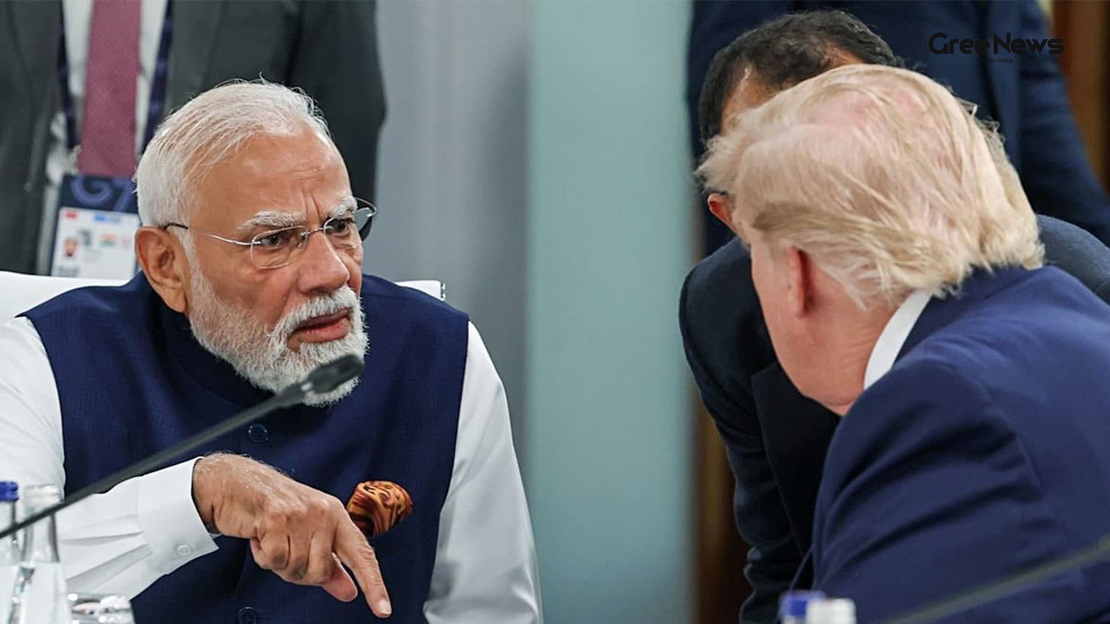
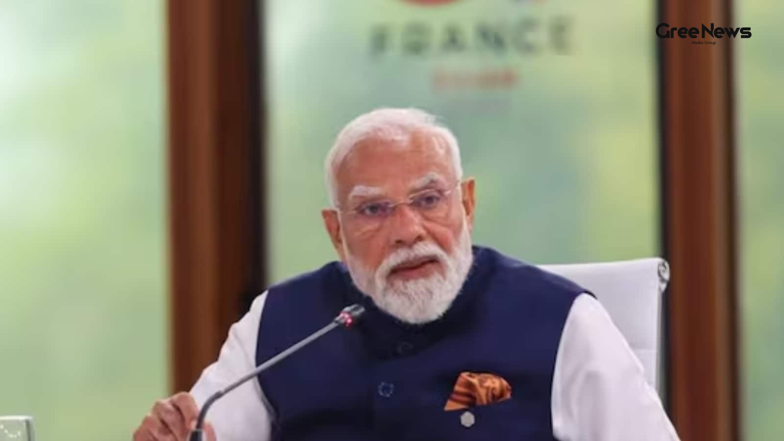
The air around international summits always smells different. It’s thick with unspoken deals and simmering tensions. And right now, that tension is particularly sharp as we look toward France, where Prime Minister Modi and President Trump are scheduled to meet on the sidelines of the G7 Summit. Wedn
Jun 17, 2026 by Gree News Team
Restoration of USPACOM: History and Geopolitical Context
They just announced something about a command name change. It’s kind of buried in the details, really. The US Department of War, which used to be called the Department of Defense that’s where this is coming from said they are dropping ‘INDO’ from the name of its oldest and largest unified combatant
Jun 17, 2026 by Gree News Team
Latest Headlines
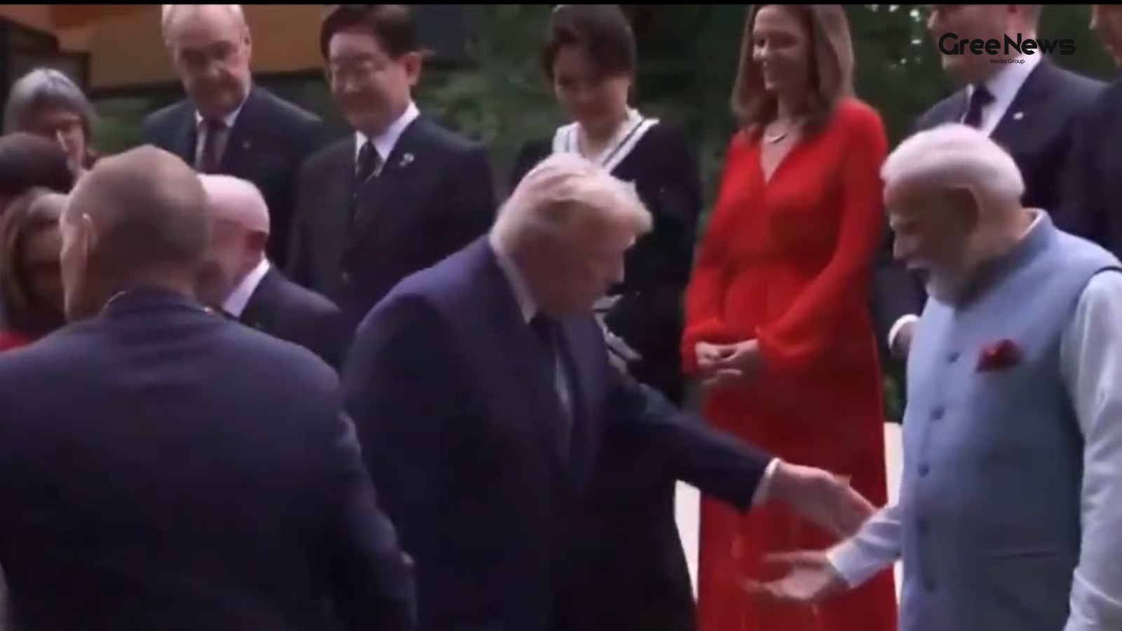
The Geopolitics of the Handshake: Analyzing the Trump-Modi Moment
The whole thing just sort of exploded online, didn't it? That little clip from the G7 Summit. It wasn’t some grand strategic maneuver or anything massive. Just a moment, really. Trump reaching for Modi’s wrist while they were walking up those steps in that French spa town, Evian-les-Bains. Suddenly,
Jun 17, 2026 by Gree News Team
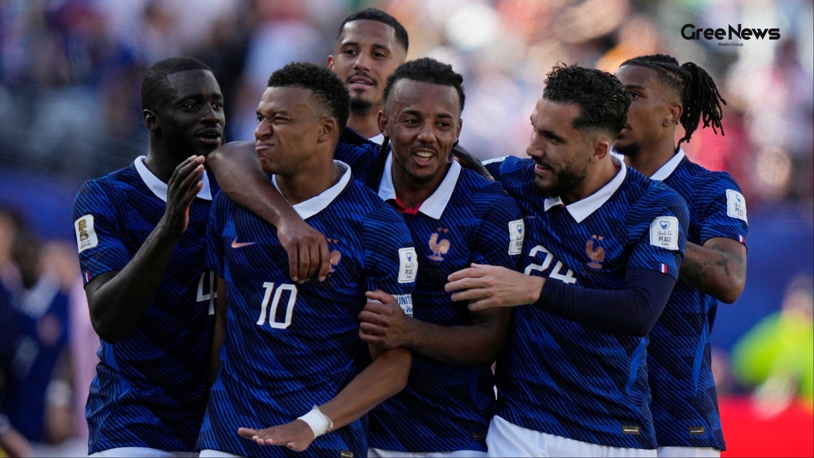
Kylian Mbappé's World Cup Legacy and Match Highlights
Kylian Mbappé took his career World Cup tally to fourteen. Two behind Miroslav Klose. And Bradley Barcola was also on target for Les Bleus. That’s what happened in that game against Senegal, securing those three points for Didier Deschamps. Mbappe darted across the box. A brilliant pass from Michael
Jun 17, 2026 by Gree News Team
The Shifting Geopolitics of the Middle East: Uncertainty and Realignment
The air around this whole situation feels thin. You know? It’s not just some headline flashing across a screen. It’s that slow, creeping realization that whatever moves happen in the Middle East right now the deals, the threats, the shifting lines on the map they don't follow any neat, predictable p
Jun 17, 2026 by Gree News Team
The $300 Billion Investment Fund for Iran and the Peace Framework
That $300 billion figure for Iran is really starting to look like one of the biggest sticking points in whatever peace framework the Trump administration is pushing with Tehran right now. If they actually nail this deal, it changes everything. It means the first major investment tied directly to the
Jun 17, 2026 by Gree News Team
The Collision of History and Possibility in Global Football Narratives
the air around that moment, you know? it wasn't just football. it was something else entirely. a strange collision of history, geography, and sheer, raw possibility unfolding on the pitch in Boston. zidane iqbal. the name itself carries this weight, doesn’t it? not just for the goals, but for what t
Jun 17, 2026 by Gree News Team
Maritime Security, Global Interdependence, and the Call for Trust
Prime Minister Modi brought this up during a G7 session, right in the middle of big international talks with leaders like Trump. It wasn’t just some standard talking point; it felt heavy, almost immediate. The backdrop was those three Indian sailors killed in that US military strike off the Omani co
Jun 17, 2026 by Gree News Team

Sanchita Ugale's Passing: Mental Health Struggles and Investigation
Sanchita Ugale’s passing really hit people hard. It wasn't just shock. It opened up this huge conversation about mental health, something everyone was grappling with right away. There were reports floating around that she had been struggling with mental health issues for some time before everything
Jun 17, 2026 by Gree News Team

Robot Vacuum Reviews and Telegram Messaging Incident in India
Keeping floors clean isn’t usually hard. Keeping them clean every day is the real challenge. Dust settles surprisingly quickly, crumbs just appear out of nowhere. Pet hair finds every corner of the house somehow. That's why robot vacuum cleaners have become so popular. They don’t replace deep cleani
Jun 17, 2026 by Gree News Team
Legal Trouble and Controversy Involving Pranit More and Himanshu Jangra
The noise around Pranit More isn't going to quiet down anytime soon. Gurugram police just slapped another FIR on the stand-up comedian. The reason? That ridiculous 'Rs 370 Biryani' comment. But it’s not just about him. Himanshu Jangra, the tech guy who actually made those remarks, is also named in t
Jun 17, 2026 by Gree News Team
Geopolitical Tension and Maritime Security at International Summits
The air around international summits always smells different. It’s thick with unspoken deals and simmering tensions. And right now, that tension is particularly sharp as we look toward France, where Prime Minister Modi and President Trump are scheduled to meet on the sidelines of the G7 Summit. Wedn
Jun 17, 2026 by Gree News Team

Indian Equities Market Update and Corporate News
Stocks moving today are going to be kind of slow, maybe a bit muted. The Indian equities market is expected to start Wednesday without much real momentum, especially after that Iran-US peace deal stuff cooled things down a bit. SGX Nifty already signals a soft opening for India. As of the morning, i
Jun 17, 2026 by Gree News Team
The Psychology of Performance: Legacy, Media, and the Narrative of Football
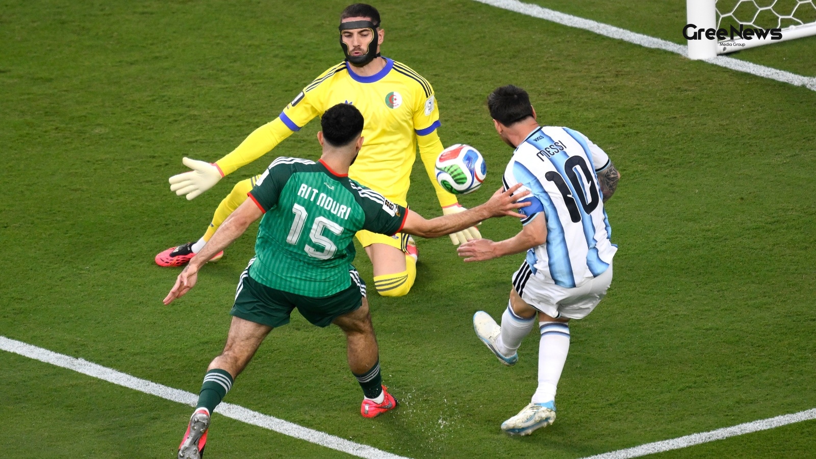
Argentina versus Algeria. The World Cup 2026 kickoff in Kansas City felt like something else entirely. Twenty years on, and you still see it. Messi. He just put on a show. A hat-trick. Three goals in a solid three-nil win against Algeria. It wasn't just a game; it was a reminder of everything. The w
Jun 17, 2026 by Gree News Team

Deportation Order Linked to Organized Crime and the Lawrence Bishnoi Gang
Something big is happening with Punjabi singer AP Dhillon’s house firing case. Canada’s Immigration and Refugee Board just ordered the deportation of Indian national Abhijeet Kingra. The reason? They found him connected to the Lawrence Bishnoi gang. This group, apparently, is involved in a lot of se
Jun 17, 2026 by Gree News Team

Cocktail 2 Rumors: Inside the Queer Speculation and On-Set Reality
It turned out that there was some noise swirling around *Cocktail 2*. A lot of talk about what the film might be about, right? Especially regarding Kriti Sanon and Rashmika Mandanna. Some reports floated around suggesting they were queer, or maybe even exploring something more intimate in the movie.
Jun 17, 2026 by Gree News Team

Karnataka's Standing Order 1061: New Guidelines on Digital Privacy and Cybercrime
A massive new directive just dropped from Karnataka. It’s called Standing Order 1061. It came from the Director General and Inspector General of Police. A big move, they say. Trying to lock down digital privacy and seriously tackle those cybercrimes specifically targeting women. The guidelines are s
Jun 17, 2026 by Gree News Team