ISRO Satellite Images Show Strong Revival of Southwest Monsoon
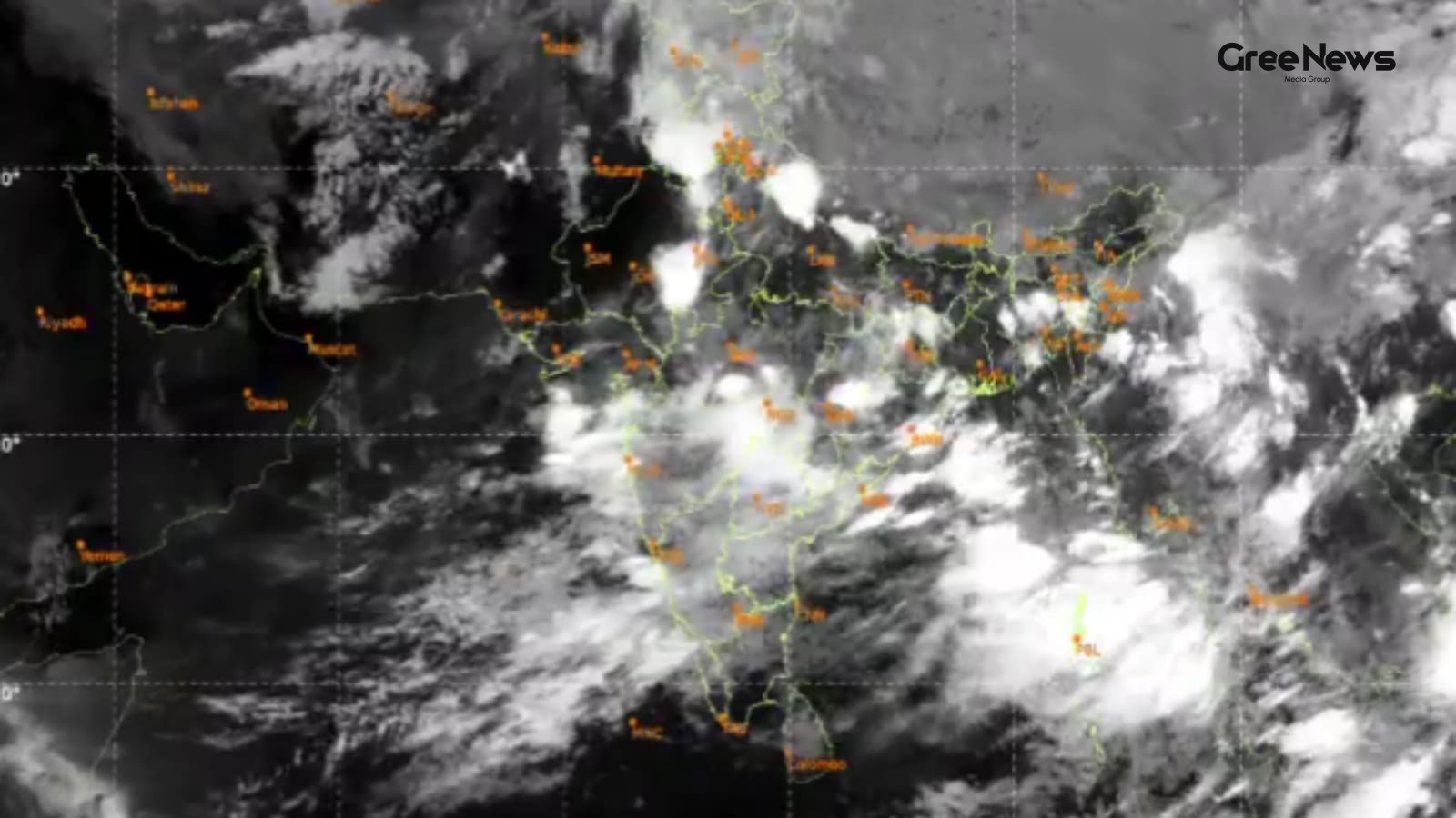
Satellite images from ISRO this Wednesday really showed something happening with the monsoon. There was a dramatic surge in cloud cover sweeping across northern India. It signals a strong revival of the southwest monsoon, especially after one of the driest Junes we've seen.
The thermal infrared pictures they captured were dense. Cloud bands stretched out from central India all the way into the Indo-Gangetic plains. This whole thing is being driven by active circulation and fresh weather systems over the Bay of Bengal.
The IMD, through ISRO’s INSAT-3DS imagery, saw this cloud mass spread across the central adjoining northern peninsula. Northwest coast, east coast, west coast it was everywhere.
We also saw moisture-laden winds converging. They were coming in from both the Arabian Sea and the Bay of Bengal right over northern India. And that monsoon trough? It's finally starting to shift closer to where it should be. That’s setting up conditions for actual rainfall across the plains.
This enhanced cloud activity isn't just theoretical anymore. It’s already brought widespread rain. We’re talking about Uttarakhand, Uttar Pradesh, Maharashtra, and several other places getting soaked already.
Earlier this week too, the imagery picked up something else. A continuous rain band nearly 1,500 kilometers long stretched from West Bengal right up to Jammu and Kashmir. It really highlights how active the monsoon is moving across a huge chunk of the country.
When you look at the satellite view, it’s clear. Tight rain-bearing clouds are stretching through eastern, central, and northern India. They aren't scattered thunderstorms; they look joined in one long line. Meteorologists are saying this really means an active monsoon circulation is kicking in. These massive clouds carry serious moisture. And they bring heavy rain to several states all at once.
The weather department noted that the southwest monsoon actually advanced into most of west Uttar Pradesh and some parts of east Haryana on July 1st, following those widespread rains and thunderstorms. Now, officials are expecting it keeps pushing north over the next twenty-four hours.
The forecasts point toward the monsoon officially setting in over Delhi-NCR, Chandigarh, and more areas in Haryana and Punjab sometime between Wednesday night and Thursday afternoon. Expect initial thunderstorms with gusty winds first. Then that’s just the start. More rainfall is expected as the whole system establishes itself across the region.
Written by Gree News Team — Senior Editorial Board
Gree News Team covers international news and global affairs at Gree News. Our collective of senior editors is dedicated to providing independent, accurate, and responsible journalism for a global audience.
More from India
View All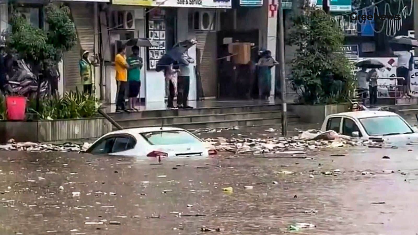
Monsoon Warning and Heavy Rainfall Forecast for Mumbai and Konkan
Mumbai is dealing with some serious monsoon trouble right now. The India Meteorological Department, IMD, just put out a warning predicting heavy to extremely heavy rain across parts of west India on Thursday, July 2nd. They said the monsoon isn't going anywhere soon. It’s an Orange warning for Mumba
Jul 2, 2026 by Gree News Team

Samik Bhattacharya and Mahua Moitra: Allegations and Political Friction in Bengal
Samik Bhattacharya, the West Bengal BJP president, just shot back at Mahua Moitra’s claims. She alleged that BJP workers actually threw eggs at her during a protest over in Nadia district. But instead of addressing the egg incident itself, he pivoted. He pointed fingers at internal Trinamool Congres
Jul 2, 2026 by Gree News Team

Egg-Pelting Drama: Political Targeting and Legal Action
Mahua Moitra, the Trinamool Congress MP, ended up in the latest wave of egg-pelting drama on Wednesday. It happened right outside her office in Nadia. People just threw eggs at the building while she was meeting workers there. There were videos of it. Both sides had footage floating around quickly.
Jul 2, 2026 by Gree News Team
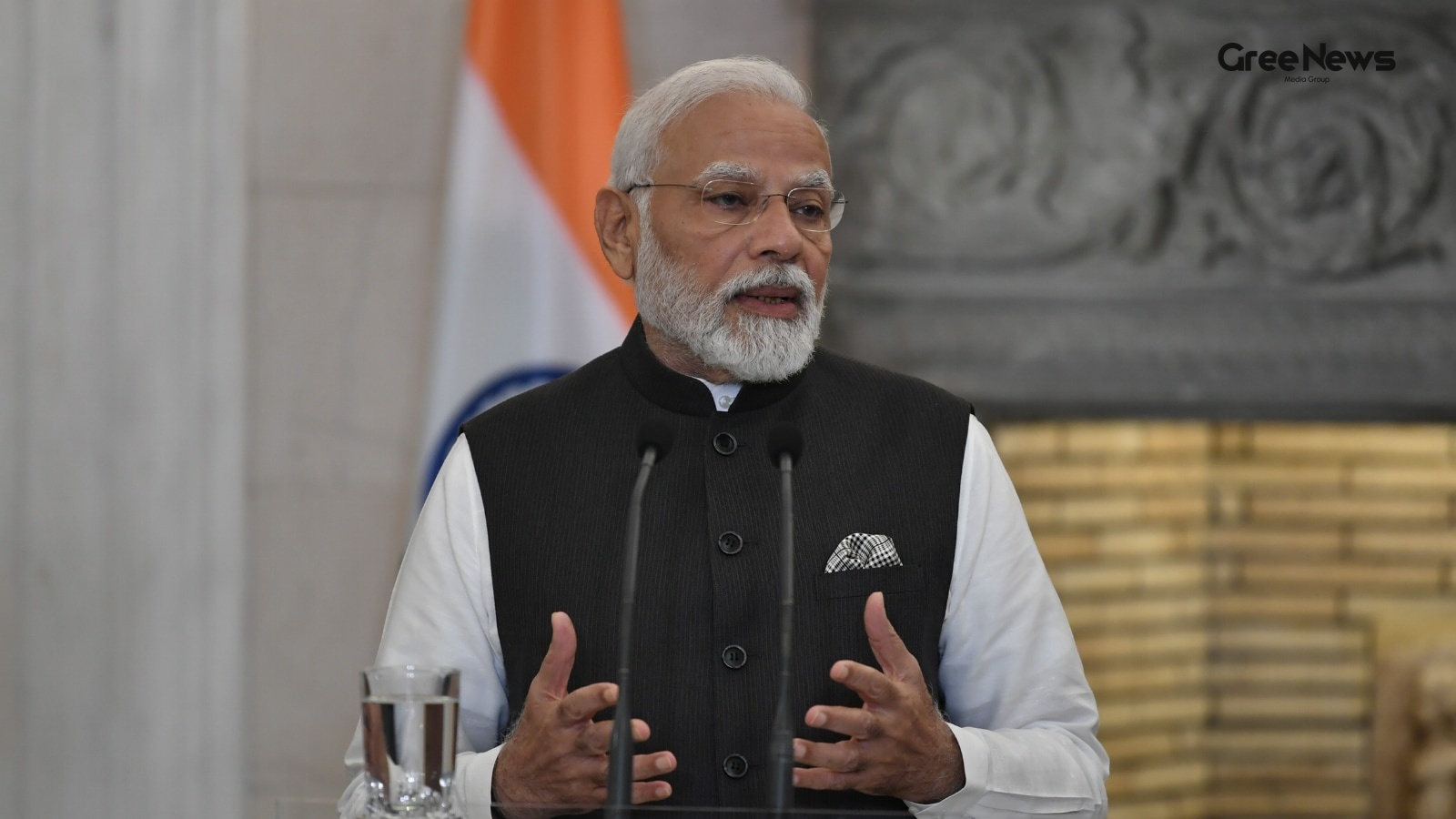
El Niño Preparedness and Monsoon Concerns in India
Modi, he’s been pushing all the ministries right now. Tell them to get contingency plans ready for El Niño. It’s about mitigating what might hit us. Concerns are really growing about this weak monsoon, and how much rain we're actually getting across different parts of the country. Sources say he rec
Jul 2, 2026 by Gree News Team
Latest Headlines

Indian Benchmark Indices Kick Off Thursday in the Green
The Indian benchmark indices kicked off Thursday in the green. Just positive global cues pushing things along, plus some solid investor sentiment overall. A tiny bump only 0.33%. It opened up at 77,083.14 after closing down slightly in the previous session. The Nifty 50 did the same thing, higher to
Jul 2, 2026 by Gree News Team

Donald Trump's Temporary Presidential Aircraft
Donald Trump flew on his newly refurbished Air Force One this past Wednesday. It was a Boeing 747-800, gifted by Qatar, serving as a temporary presidential aircraft while they wait for the new planes. That plane, worth about four hundred million dollars, obviously looks different. Gone was that fami
Jul 2, 2026 by Gree News Team
Monsoon Warning and Heavy Rainfall Forecast for Mumbai and Konkan
Mumbai is dealing with some serious monsoon trouble right now. The India Meteorological Department, IMD, just put out a warning predicting heavy to extremely heavy rain across parts of west India on Thursday, July 2nd. They said the monsoon isn't going anywhere soon. It’s an Orange warning for Mumba
Jul 2, 2026 by Gree News Team

The Reality Behind the BAT-BMS E-Rickshaw Videos
Those viral videos started causing real panic online, you know? People are seeing these clips where folks allegedly switch off moving e-rickshaws just by using a smartphone app. The whole thing centers around this application called BAT-BMS. It’s some kind of Chinese battery monitoring system, but a
Jul 2, 2026 by Gree News Team
Samik Bhattacharya and Mahua Moitra: Allegations and Political Friction in Bengal
Samik Bhattacharya, the West Bengal BJP president, just shot back at Mahua Moitra’s claims. She alleged that BJP workers actually threw eggs at her during a protest over in Nadia district. But instead of addressing the egg incident itself, he pivoted. He pointed fingers at internal Trinamool Congres
Jul 2, 2026 by Gree News Team
Egg-Pelting Drama: Political Targeting and Legal Action
Mahua Moitra, the Trinamool Congress MP, ended up in the latest wave of egg-pelting drama on Wednesday. It happened right outside her office in Nadia. People just threw eggs at the building while she was meeting workers there. There were videos of it. Both sides had footage floating around quickly.
Jul 2, 2026 by Gree News Team

ISI's Shift to Soft Power and the Khalistan Movement in the Diaspora
The ISI, Pakistan’s intelligence agency, is leaning heavily on "soft power" networks now. It's using these connections to keep the Khalistan movement alive among the Sikh diaspora in Canada. Top intelligence sources are pointing to this shift. It looks like they’ve moved away from direct militant su
Jul 2, 2026 by Gree News Team
El Niño Preparedness and Monsoon Concerns in India
Modi, he’s been pushing all the ministries right now. Tell them to get contingency plans ready for El Niño. It’s about mitigating what might hit us. Concerns are really growing about this weak monsoon, and how much rain we're actually getting across different parts of the country. Sources say he rec
Jul 2, 2026 by Gree News Team

Donald Trump's Financial Disclosure and Pakistan Deal
Donald Trump apparently pulled in at least two billion dollars in revenue during 2025. That includes about $1.4 billion coming from cryptocurrency ventures held in trusts that benefit him, according to a massive 927-page disclosure filed with the Office of Government Ethics. It’s a lot of money, and
Jul 2, 2026 by Gree News Team

Benjamin Netanyahu's Remarks on American Aid, Security, and Regional Conflicts
Benjamin Netanyahu dropped some heavy remarks on Tuesday about American aid. He basically said he wants to stop it. The argument was that Israel’s economy is strong now. It can handle things itself without relying on US assistance. “I want to stop American aid,” he stated plainly. “It’s like welfare
Jul 2, 2026 by Gree News Team
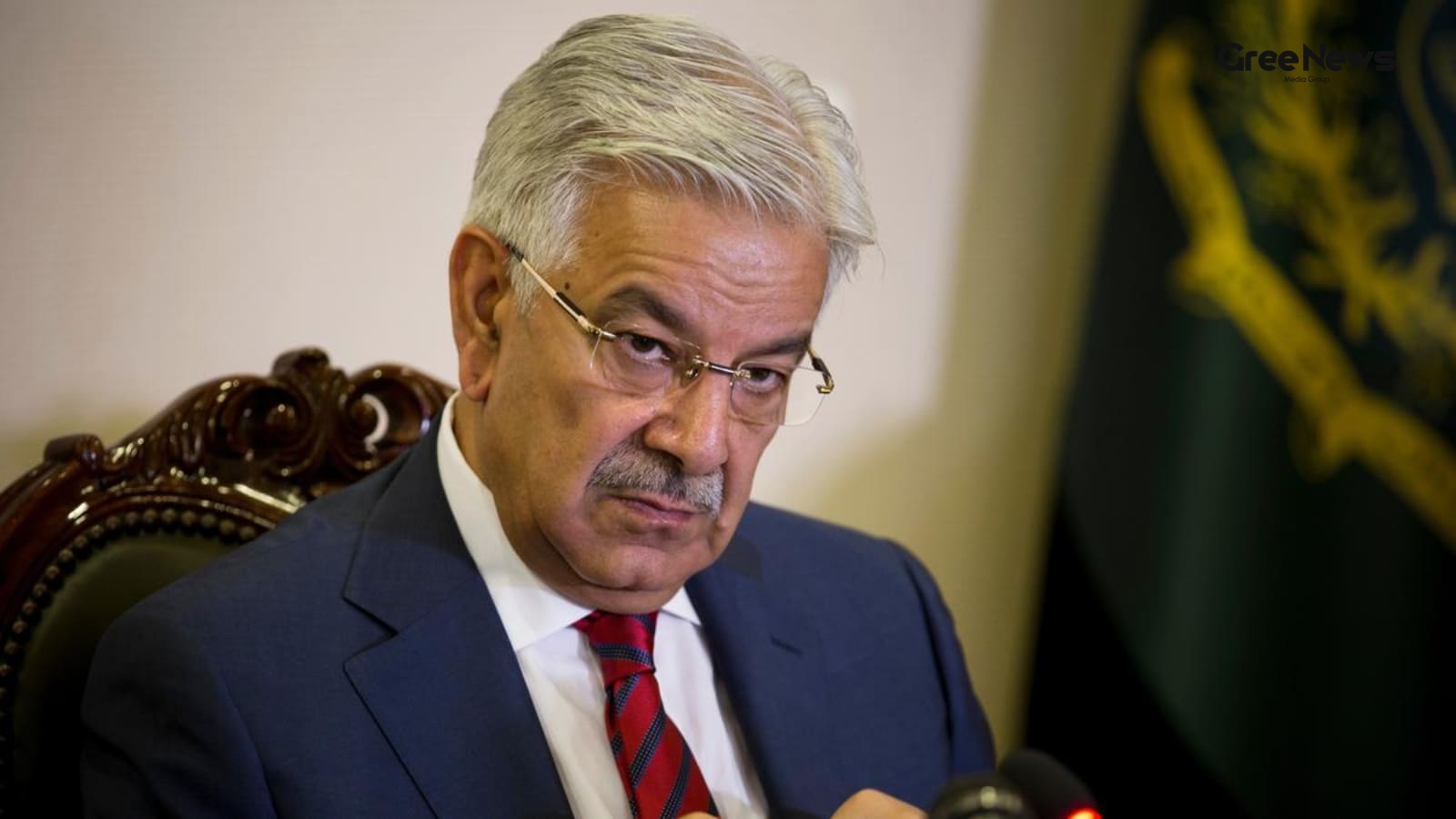
Water War Threat: India, Pakistan, and the Indus Waters Treaty
Khawaja Asif, Pakistan’s Defence Minister, just threw out a warning. A full-blown “water war,” he said. He threatened military retaliation if things don't cool down. All because India essentially tossed the 65-year-old Indus Waters Treaty into limbo. It felt like a desperate move by Islamabad, tryin
Jul 2, 2026 by Gree News Team

Murder Investigation: Deception and Discovery in Rajkot
A man from Rajkot, from Gujarat, apparently fell into a relationship with someone he met online. A "girl," they said. Things escalated fast. Within a short time frame, Piyush Kumar started living with Poonam and even got married to her. But then, something shifted. One day, Piyush allegedly found ou
Jul 2, 2026 by Gree News Team

WhatsApp Username Holdback and Government Scrutiny
WhatsApp is talking about holding back usernames for now. They said they’re going to keep names of public figures, government stuff, celebrities and verified Meta accounts reserved under this new feature. That came shortly after the Centre sent a notice to Meta. The worry was clear: people feared th
Jul 2, 2026 by Gree News Team

Russia Imports Gasoline from India Amid Fuel Shortages
Russia is starting to import gasoline from India by sea. This move comes to address fuel shortages across the country. The trouble started when Ukrainian drone strikes hit Russian refineries. Two industry sources told Reuters about this on Wednesday. Meanwhile, ship tracking data showed Indian refin
Jul 2, 2026 by Gree News Team

5.5 Magnitude Earthquake Hits Near Jurm in Afghanistan
A 5.5 magnitude earthquake hit near Jurm in northeastern Afghanistan this Wednesday. That’s what the United States Geological Survey reported. It struck at a depth of 216.7 kilometres, about 134 miles down. No immediate reports came through about any casualties or damage right after it happened. Jur
Jul 2, 2026 by Gree News Team